Make an inquiry

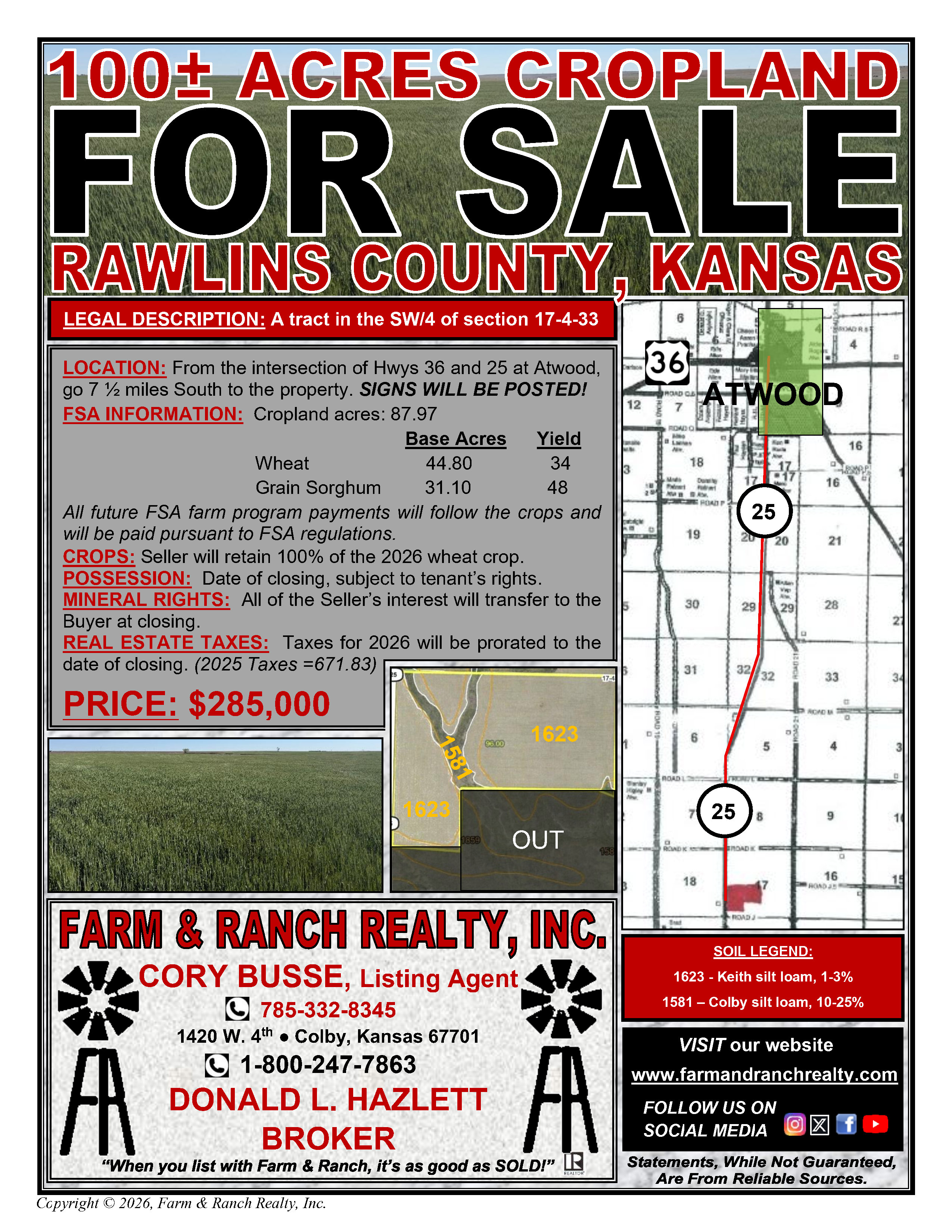
100± CROPLAND - RAWLINS COUNTY, KANSAS
RAWLINS Kansas
.jpeg)
Legal Description: A tract of land in the Southwest Quarter (SW/4) of Section Seventeen (17) in Township Four (4) South, Range Thirty-three (33) West of the Sixth Principal Meridian, more particularly described as follows:
Commencing at the Southwest Corner of the Southwest Quarter (SW/4) of Section Seventeen (17) in Township Four (4) South, Range Thirty-three (33) West of the Sixth Principal Meridian; thence North 89°33'12" East 51.00 feet to a point; thence North 00°02'09" East along the East K-25 Highway right-of-way 527.01 feet to the point of beginning; thence South 87°51'14" East 798.76 feet to a point; thence North 00°56'02" West 751.74 feet to a point; thence North 89°43'32" East 1674.49 feet to a point; thence South 72°59'16" East 159.62 feet to a point; thence North 00°14'21" East 1440.88 feet to a point; thence South 89°36'20" West 2617.83 feet to a point; thence South 00°02'09" West along the East K-25 Highway right-of-way 2105.90 feet to the point of beginning.
LOCATION: From the intersection of Hwys 36 and 25 at Atwood, go 7 ½ miles South to the property. SIGNS WILL BE POSTED!
FSA INFORMATION: Cropland acres: 87.97
BaseAcres Yield
Wheat 44.80 34
Grain Sorghum 31.10 48
All future FSA farm program payments will follow the crops and will be paid pursuant to FSA regulations.
CROPS: Seller will retain 100% of the 2026 wheat crop.
POSSESSION: Date of closing, subject to tenant’s rights.
MINERAL RIGHTS: All of the Seller’s interest will transfer to the Buyer at closing.
REAL ESTATE TAXES: Taxes for 2026 will be prorated to the date of closing. (2025 Taxes =$671.83)
$285,000
Share:
Sale Bills
Gallery
.jpeg)
.jpeg)
.jpeg)
Video
Land Map
Soil Map


